3D Applications in Infrastructure Projects
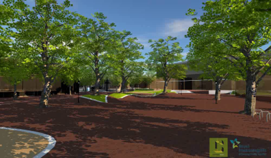
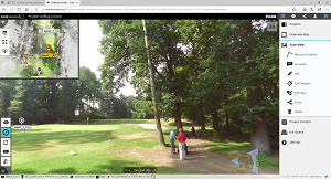
We are also no strangers to scanning roads and terrains. For example, we were involved in the redevelopment of a city center, where a large area was surveyed by us to provide insight into the effects for residents and shop owners. By scanning a number of fixed reference points, the entire model was placed within the RD coordinate system. Additionally, we have also mapped golf courses for renovation and landscape architecture purposes.
Benefits of 3D Scanning
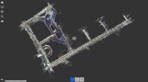
The Faro Focus Premium laser scanners used by 3DLS are the perfect solution for any 3D laser scanning task. They provide excellent range, outstanding speed, and high-quality visuals. With a laser scanner, we can perform highly accurate measurements at high speed. The scanner works by scanning thousands of points per second. It then connects these points into a 3D point cloud that forms a realistic and accurate representation of reality.
The greatest advantage is that you obtain highly valuable data with relatively little effort and at low cost. We own a mobile, compact scanner that is practically applicable anywhere.
3D Laser Scanning for Infrastructure Projects
We understand that especially for large infrastructure projects, there is a need to map environmental factors accurately and to measure distances precisely—data that should always be accessible to the organizations and professionals who need this 3D infrastructure data. We can safely store our scan data in the cloud via Benaco, allowing the data to be easily shared with all stakeholders. Interested in a demo? Schedule an appointment with the 3DLS team.
 Read more...